This part of West Yorkshire is an area of contrasting landscapes, from scenes of industrialisalition in the main valleys to sparsely populated moorland valued for its recreational use and rugged beauty. The present scenery is a reflection of how geological processes operating over millions of years have moulded the original rock foundations into the hills and valleys of today. Pule HillThe landscape is continually changing in response to the earth’s natural processes and human activity. From t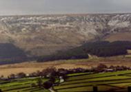 he summit of Castle Hill near Almondbury can be seen varied landscapes, from the bleak Pennine gritstone moor
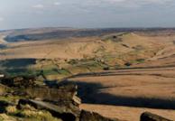 s to the gentler countryside stretching out to the east. Deeply cut into the landscape, the rivers of the Colne and Holme valleys lie hidden from view as they flow from upland sources towards the industrial town of Huddersfield. The town is located at the confluence of the Colne and Holme valleys where View from Holme Mossthere is relatively fiat ground formed by the lowest beds of the Coal Measures. From the higher ground
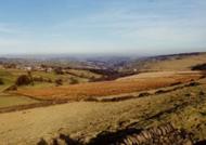 , wooded tributary valleys (doughs) carry fast flowing streams to the main rivers. On the gentler slopes above the valleys, villages and farms can be seen scattered across the landscape with distinctive patterns of dry stone walls and hedges enclosing cultivated land. The underlying rocks have played an important role in the development of this Pennine landscape. The Millstone Grit Series View from Moor Side to Deer Hill and Coal Measures comprise alternate beds or layers of sandstones and shales with different rates of erosion. The harder sandsto
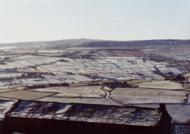 nes create distinct landforms known as benches or plateaux, whilst the softer and more easily eroded shales form the steeper valley slopes. Some over-deepening of the Colne and Holme valleys occurred towards the end of the last ice age, approximately 15,000 years ago. Rising temperatures melted immense quantities of snow and ice from the frozen ground. The release of this vast amount of post-glacial melt water deepened the two valleys, erosion being promoted by a lack View from Castle Hill to Kirkburton of vegetation cover. The regional tilt of the local rock is eastwards. The weathering and erosion of rock s
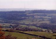 trata has created a series of escarpments with steep westward facing scarp slopes and gentler dip slopes to the east. To the northwest from Castle Hill, sandstone beds form the Hall Bower and Newsome benches, with shales forming the intervening steep slopes of the Coal Measure escarpments. Beneath these escarpments, hidden in the depths of the Holme valley, lies the boundary between the Coal View from Castle Hill to West Nab Measures and the older Rough Rock, which forms the uppermost bed of
 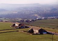 the Millstone Grit. Further benches of Grenoside and Greenmoor sandstones have provided flat, well-drained sites for the nearby villages of Almondbury to the east and Farnley Tyas and Shepley to the southeast, where many of the traditional stone buildings are built from locally quarried sandstone. For more information about the rocks which make up the coal measures see our Local Geology – Rocks section.
Millstone Grit Landscapes
West of Castle Hill beyond the Holme Valley, the Coal Measures have been removed by erosion.

Underlying beds of Millstone Grit have weathered into west facing gritstone escarpments such as Pule Hill and Standedge. Many of these edges have eroded into strange shaped blocks and boulders. Gritstone edges characterise Pennine landscapes, often forming a series of landmarks, proudly standing out against distant skylines. View from Quamby to LinthwaiteEastwards from Castle Hill towards Fenay Beck and Kirkburton, the landscape takes on a gentler appearance, influenced by the underlying shales of the Coal Measures and the relative lack of thick sandstones. Clay soils, developed from the weathering of 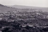 shales, led to the establishment of pleasant stretches of deciduous woodland found at Royd House Wood, Farnley Bank and Carr Wood. The valley below seems too deep for the small Rushfield Dike running north eastward, which may be described as a misfit stream, suggesting that the valley was previously shaped by a much larger and more powerful river, perhaps glacial melt Drainage channels on Holme Mosswater. To the east of Fenay Beck, Lepton Edge forms the next escarpment, with the villages of Emley, Flockton and Grange Moor on sandstones benches, which dip gently at about 5 d
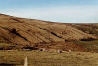 egrees to the east. This scarp and dip landscape, although not visible from Castle Hill, continues further to the east beyond the district, where the Woolley Edge escarpment forms the high ground beyond West Bretton. The highest terrain of the district lies to the south west where Huddersfield White Rock sandstone underlies the peat covered moors of Black Hill and Holme Moss. On this treeless and exposed landscape only resilient mosses, moor grasses and the distinctive cotton grass can survive in the harsh climate on impoverished acid soils which develop from a quartz rich sandstone. In places where vegetation has been removed by acid rain and erosion, the exposed peat is cut into deep drainage channels, called groughs. The flanks of these upland gritstone plateaux are dissected by numerous steep rocky cloughs, containing waterfalls, where streams tumble over alternate beds of soft shales and resistant sandstones. Natural processes are continually modifying the landscape. On steep slopes such as March Hill, north west of View from Holme Moss over the reservoirsMarch Haigh Reservoir near Marsden, and West Nab near Meltham, down-slope movements have resulted in landslips. The upland areas r
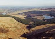 eceive high levels of rainfall and are the source of much of the district’s water supply as they replenish the numerous reservoirs dotted across the landscape. This stored water is used mainly for Yorkshire Water’s public supply but also by local industry and to maintain the Huddersfield Narrow Canal’s water level. For more information see our Local Geology – Water section The rocks of an area are often revealed in the selection of materials used for the building of houses and dry stone walls. In many Pennine villages and farms, the use of locally quarried sandstone creates a distinctive landscape where dark weathered buildings blend naturally into the local scenery. The use of hedges and fences as field boundaries indicates the presence of shales and the scarcity, or even absence, of local sandstones. In many areas of the Coal Measures, where shales and clays form a high percentage of the underlying rock, bricks were often manufactured and replaced sandstones as the predominant building material. For more information about the use of local stone see our Local Geology – Quarrying section.